Subject: Alaska
Period: 1898 (dated)
Publication:
Color: Printed Color
Size:
28.5 x 23.5 inches
72.4 x 59.7 cm
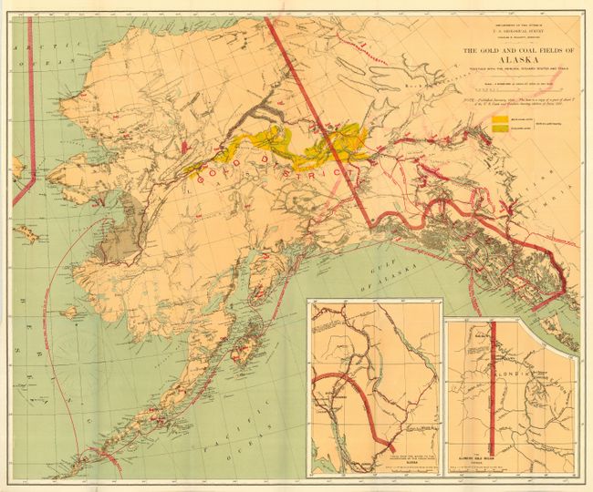
A fine geological map printed in the five-color lithographic method with considerable place name detail. The Birch Creek and Forty Mile gold regions are prominently shown. Strong red over printing is used to detail steamer routes, trails, and the gold regions. There are two insets: "Trails from the tide water to the headwaters of the Yukon River, Alaska" and "The Klondike Gold Region, Canada." The large Fort St. Michael Military Reservation is shown centered on Norton Sound. The monthly steamer routes servicing areas from Norton Sound, along the south side of the Aleutians and along the Alaskan Coast to San Francisco are shown. Note below the title indicates the map was published in January, 1898 and based in part on a portion of the 1897 Chart T of the U.S. Coast and Geodetic Survey. Published by the Department of the interior, Charles D. Walcott, Director. A really nice example of this great map from the Alaskan Gold Rush period.
References: Falk (AK) #1898-51; Phillips (AK) p. 117.
Condition: A
On heavy paper, beautifully colored and folding as issued. With some light color offsetting from the strong red over printed coloring, as is always the case with this map, else fine.