Subject: Northwestern United States
Period: 1860 (dated)
Publication: New General Atlas
Color: Hand Color
Size:
13.8 x 10.8 inches
35.1 x 27.4 cm
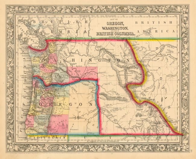
In 1859, Oregon became a state and in the process Washington Territory gained land from Oregon that eventually became Idaho and part of Montana. It clearly shows the Oregon Trail, and the Emigrant Wagon Road to California. The entire eastern half of Oregon is unorganized with Klamath, Curry and Wasgoren (likely an editing error for Wasco) Counties being the furthest east. The eastern part of the state is labeled as unexplored. Klamath County was not organized until 1882, so its appearance here is a mystery, as the decorative floral border of this edition was replaced long before 1882.
References:
Condition: A
Lovely, strong original color, dark impression and full margins. Some marginal toning or soiling, map image is near fine.