Subject: Western United States
Period: 1877 (dated)
Publication: Annual report of 1st. Lieut. M.M. Macomb
Color: Printed Color
Size:
22 x 16 inches
55.9 x 40.6 cm
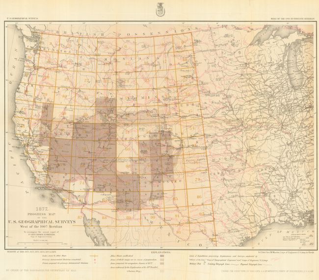
A remarkable and attractive map that reflects the survey efforts in the West. It is a detailed representation of the various routes of western expeditions and the important surveys of King (40th parallel), Wheeler, Powell & Hayden. This edition includes the survey seasons of 1869, and 1871 through 1877. Among the details are the locations of occupied and abandoned posts, astronomical stations, signal service stations, telegraphic lines, and the routes of cattle droves and trains. It is a virtual tour de force of prior explorations and surveys with more information than we've seen on any other map. Published in Lieut. George M. Wheeler's Annual Report under the direction of Brig. Gen. A.A. Humphreys, Chief of Engineers. The progress maps are among the most interesting, informative and useful maps of the West.
References:
Condition: A
Issued folding. Fine color and impression. Map is fine less short tear at binding trim closed on verso with tape and light offsetting visible at lower margin in blank areas.