Subject: Western United States
Period: 1851 (dated)
Publication: Smith's Quarto Geography
Color: Hand Color
Size:
8.8 x 10.4 inches
22.4 x 26.4 cm
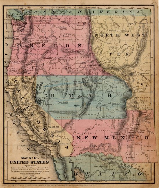
A very nice map of the West with early territorial boundaries. New Mexico Territory is shown with the pre-Gadsden Purchase border along the Gila River plus its northern extension into today's Colorado. Oregon covers Washington and east to the Continental Divide and a huge North West Territory occupies the area to the east with a small area northeast of Utah labeled Nebraska. The large Utah Territory reaches to California and to the Continental Divide in today's Colorado and touches a small portion of Indian Territory, which locates Arapahos and Cheyennes, but is unnamed here. States/territories are labeled with their population: Utah 11,000, New Mexico 62,000, Oregon 13,000, California 165,000. Locates numerous Indian tribes and military forts.
References:
Condition: B
Nice color and impression with original margins. Some scattered foxing or light staining.