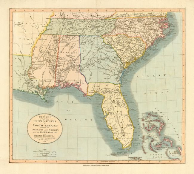
Subject: Southeast United States
Period: 1819 (dated)
Publication: New Universal Atlas
Color: Hand Color
Size:
20 x 18 inches
50.8 x 45.7 cm
This is a great map of the Southeast issued during a period of rapid change and advancement. Published in January of 1819, this map depicts the region on the eve of the United States' acquisition of East Florida from Spain by the Adams-Onís Treaty (February 22, 1819). It also shows Alabama Territory just prior to its statehood in December of 1819. The map is filled with information on the roads, portages, forts, Indian villages, settlements and topography. It is also remarkable for the many interesting notes, including the Principal Hunting Grounds of the Western Party and Six Villages in Mississippi. In Florida, Fort St. Marks, Apalacha Fort, and the roads from St. Augustine are shown, with a note that the Apalachees Villages are now almost all deserted. Southern Florida is labeled Ancient Tegesta. A lake and river system connects Mayaco Lake (Lake Okeechobee) with the St. Johns River. The map extends to provide good detail of the Bahamas including a notation on Guanihani or Cat Island that it was the first Land of American Discovered by Columbus - a common misconception of the period.
References:
Condition: A
Some soil and minor flaws in blank margins, not affecting map.