Subject: Colonial Southeast United States
Period: 1747 (published)
Publication: A Complete System of Geography
Color: Hand Color
Size:
17 x 13.5 inches
43.2 x 34.3 cm
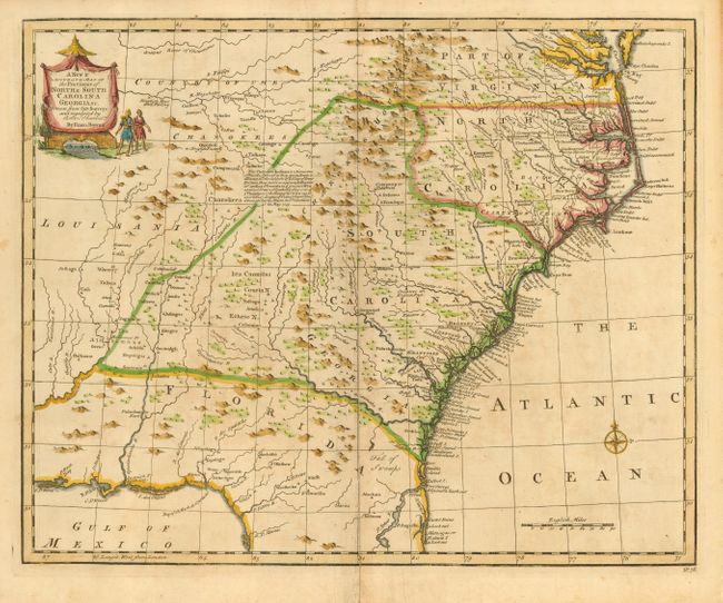
This detailed map covers the region from Chesapeake Bay to St. Augustine, Florida and west to Pensacola Bay and the Country of the Charokees. The map is derived from the Carolina sheet of Popple's great twenty-sheet map of North America (1733). It is most notable for its placement of forts and Indian villages. It also includes information on towns, early forts, mines, and several English Factories. Text at center describes the alliance made by the British with the Cherokees to provide a buffer against French and Spanish military advances. This is the first state with No. 76 in bottom right margin.
References: Cumming (SE) #263; Sellers & Van Ee #1380; Williams & Johnson #9.
Condition: B
Minor uneven toning. Old repairs of centerfold including a short tear extending from the centerfold near the <I>Charokee Mountains</I>, and a tear in bottom blank margin.