Subject: Colonial Southern United States
Period: 1775 (dated)
Publication: The West-India Atlas
Color: Hand Color
Size:
24.5 x 18.8 inches
62.2 x 47.8 cm
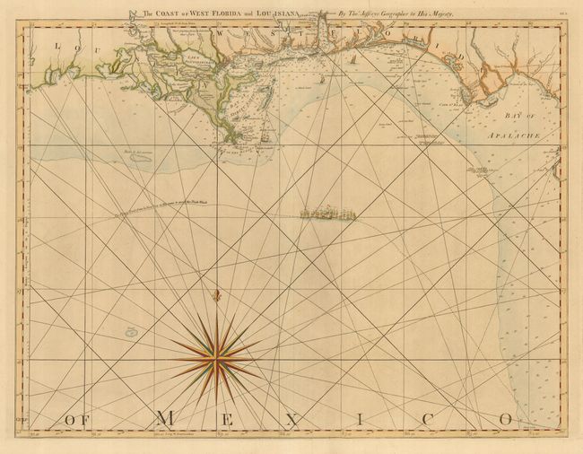
This fine sea chart covers the Gulf coast from Cabo del Norte, Louisiana to Apalache Bay, Florida. Detail is confined to the coastline with harbors, inlets, bays, river entrances, soundings, rocks, shoals, and currents. Several forts, settlements and villages are located and the start of the road from Fort St. Marks to St. Augustine is shown. The map is ornamented with a dramatic compass rose, rhumb lines, and a fleet of sailing ships marking "The Flota's Track from la Vera Cruz to Havanna to avoid the Trade Winds." This is the second state with Robert Sayer's imprint at bottom. It has been revised from the first state with Bay of Spiritu Santo and new information added above New Orleans. It is one sheet of the sixteen-sheet map of the West Indies that formed the heart of this important Revolutionary period atlas. Sheet number DF.3 printed at upper right.
References: Sellers & Van Ee #1608; Stevens & Tree #26.
Condition: A
Tear in top margin, just entering title, with tissue repair on verso.