Subject: World
Period: 1695 (circa)
Publication:
Color: Hand Color
Size:
14 x 10 inches
35.6 x 25.4 cm
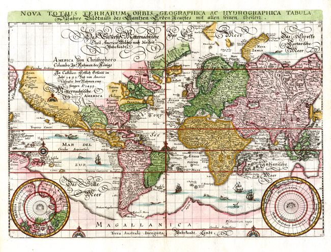
Merian based the cartography of this map on Blaeu's world map of 1606. Latin title at top, outside neatline. A German script title and notation concerning the discovery of the Americas in 1492 covers the unknown interior of North America. There is a large southern continent connected to New Guinea, California is a peninsula and there are plenty of open ended waterways in the eastern part of North America alluding to a possible Northwest Passage. Two polar projections occupy the lower corners. The map is richly decorated with numerous sea monsters, galleons and compass roses. Second state without Merian's imprint.
References: Shirley #345.
Condition: A+
Expert repair on marginal tear on bottom centerfold.