Subject: World
Period: 1651 (dated)
Publication:
Color: Hand Color
Size:
20.5 x 13.8 inches
52.1 x 35.1 cm
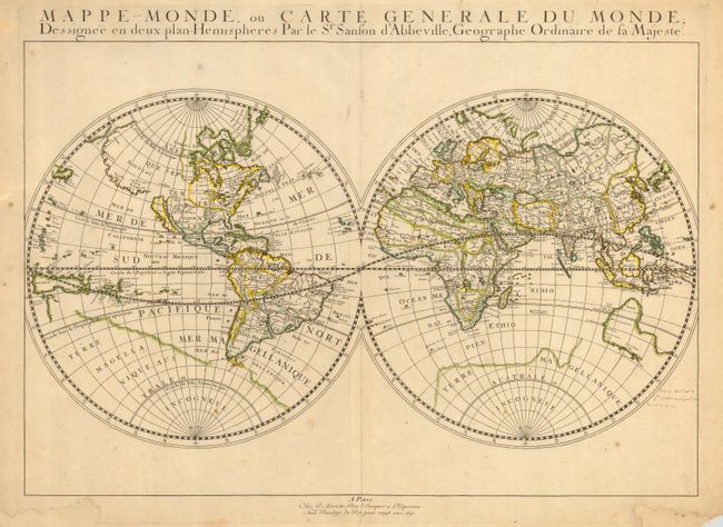
Important double hemisphere world map showing California as an Island. It is one of the first maps to distinguish the Great Lakes and name Lac Superior and Lake Michigan, here called Lac des puans (lake of evil smells). All five of the Great Lakes were not named until Sanson's 1656 map of New France. The faint outline of Terra Magellanica appears in the south. Australia is only partially shown, and labeled simply Beach, with place names on the south and west coasts reflecting Dutch discoveries. Neither Tasmania or New Zealand is shown. The map is typical of Sanson's "scientific" style of cartography with no decorative elements. It was published in conjunction with Pierre Mariette (father and son), who published many of Sanson's works after 1645.
References: Shirley #390.
Condition: B
Nice impression with original hand color. Old paper restoration to margins, with the engraver's name gone. Very early manuscript just to the right of the map, hinge remnants on verso.