Subject: Canada
Period: 1761 (published)
Publication: London Magazine
Color: Hand Color
Size:
12.8 x 9.3 inches
32.5 x 23.6 cm
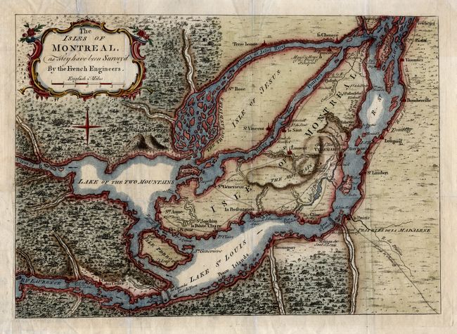
This interesting French and Indian War period map of Montreal and vicinity was based on the French maps initially drawn from manuscripts brought back to Paris by Pierre Francois Xavier de Charlevoix, a Jesuit who traveled extensively in Canada between 1705 and 1720. The map depicts the vicinity of Montreal, which was located at the navigable limits of the St. Lawrence River. Montreal or Ville Marie is depicted as a walled and fortified city. It is surrounded by many defensive forts that were built as protection against the Iroquois. Roads and trails are well depicted. The River St. Jean is shown as a wide channel clogged with islands, and several rapids and waterfalls are shown along the St. Laurence. This map was published just as news of the final British victory over Montreal was circulating in London.
References: Jolly LOND-196.
Condition: B
Issued folding, now pressed. Long binding tear across upper left corner, though title cartouche has been repaired.