Subject: Canada - Maritime Provinces
Period: 1695 (circa)
Publication: Atlante Veneto
Color: Black & White
Size:
24 x 17.5 inches
61 x 44.5 cm
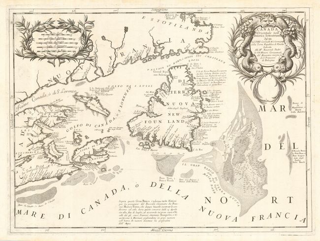
This handsome map is based on Nolin's earlier map of the region in 1685, but is focused on Newfoundland and the mouth of the St. Lawrence, showing Nova Scotia, Cape Breton, Isle de Anticosti and Prince Edward Island. Coronelli has taken the relevant area from Nolin's map and transcribed it with a magnificent, aquatic cartouche. There is particular interest paid to the Grand Bank and other fishing banks of the region, mapping them as carefully as the coastline. There are some notations on the map by Coronelli referring to the quantity and varieties of fish to be found in the waters. Per Kershaw, "The map is of considerable importance to a collector as derivatives of Nolin's maps, which are now readily available."
References: Kershaw #162.
Condition: A+
A gorgeous impression on Coronelli's typically white paper. Couple tiny creases in margins.