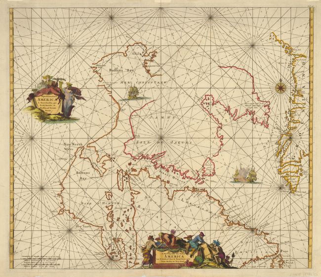
Subject: Canada and Greenland
Period: 1715 (circa)
Publication: Atlas de la Navigation, et du Commerce…
Color: Hand Color
Size:
21.8 x 18.8 inches
55.4 x 47.8 cm
This is De Wit's fine chart of Hudson Bay and Arctic Canada based on Van Loon's important chart of the region. It covers Hudson Bay and Strait, Baffin's Bay, part of Greenland, Labrador, etc. This is probably the third state, issued by Renard. Kershaw notes that this state has the additions of the names James ou Isle de Jaques and Baye d'Hudson and the addition of numerous place names around the western and southern shore of Hudson Bay. The only apparent difference being that this example is numbered Fol. 28 at upper right, instead of Fol. 26. Embellished with rhumb lines, a compass rose, sailing ships (two engaged in battle), and two splendid cartouches; the second with the Dutch title: De Noordelyckste Zee kusten van America van Groenland door de Straet Davis ende. . .
References: Kershaw #211.
Condition: B
Nice impression with some light spots throughout map and some short tears in the bottom margin, a few just into map but repaired with archival tape. Hinge remnants on verso.