Subject: North America
Period: 1843 (circa)
Publication:
Color: Hand Color
Size:
12 x 15 inches
30.5 x 38.1 cm
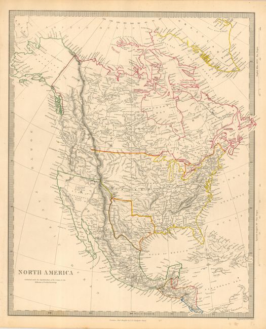
Detailed and finely engraved map portraying an Independent Texas and Mexico controlling Nueva California. The boundary between Canada and the United States is left uncolored, leaving the ownership of Oregon Territory (here labeled Columbia) unknown - which is unusual for a British map. Filled with well developed topography, the map names numerous forts, trading posts, Indian tribes and locates L. Youla roughly near the Great Salt Lake with the American Fur Depot on its eastern shore. The R. Buenaventura extends to the Pacific from two branches, one originating from a large swamp in the Great Basin. The course of the Snake River is fairly accurate, but the Colorado River originates too far north and rushes to the Sea of Cortez in a straight line. Locates the 3 buttes in present-day Idaho -- important landmarks on the Oregon Trail. Lake Michigan retains its erroneous elongated shape. Distance scales outside of border give English Miles and Spanish Leagues. Engraved by J. & C. Walker and published by Charles Knight.
References:
Condition: A
Nice example with original hand coloring in outline. A little marginal toning or soiling.