Subject: Atlases, United States
Period: 1874 (dated)
Publication:
Color: Hand Color
Size:
16.3 x 21.8 inches
41.4 x 55.4 cm
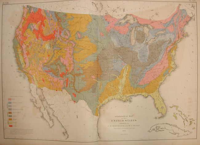
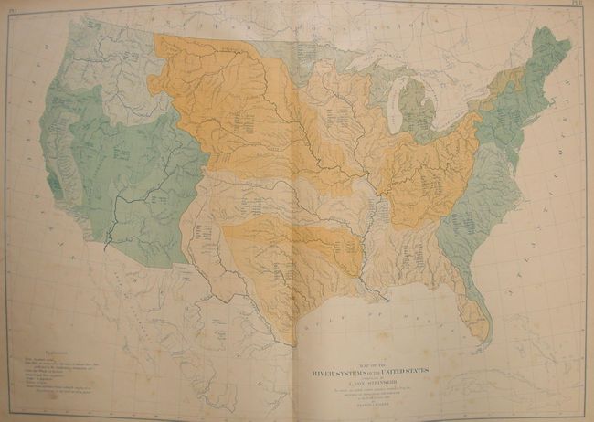
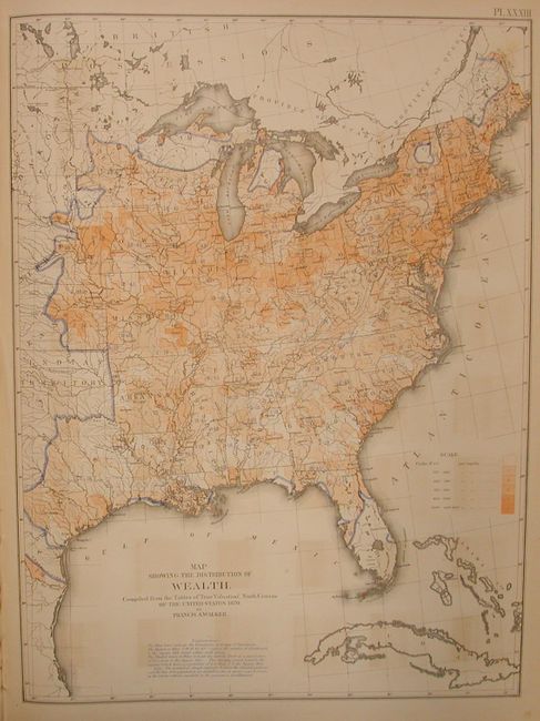
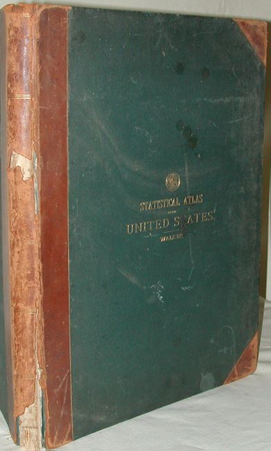
This large and important atlas is the first statistical atlas of the United States. It is complete with fifty-four plates, most double-page maps, providing a view of the physical, economic, and social geography of the United States. Most maps are colorful and thematic in nature including the desirable "Geological Map of the United States" by Hitchcock. Of special interest are the maps that show the population density for each decennial census from 1790 to 1870. Schwartz & Ehrenberg commend this atlas saying it was a "pioneering work [and] was the first atlas of analytical maps that showed the patterns of associations and it greatly influenced the development of thematic mapping in the Untied States." Francis A. Walker was the Superintendent of the Ninth Census and Professor of Political Economy and History in the Sheffield Scientific School at Yale College. Folio, 1/4 leather, text, plus map plates. Covers are blind stamped in a pattern with gilt title and the seal of the Department of the Interior. An important and desirable atlas with clean contents that will benefit from rebinding.
References: Schwartz & Ehrenberg p. 303.
Condition: B
Contents and maps are generally very good or fine, with a few affected by light occasional foxing. The leather on the spine has rips and tears with pieces missing and the front cover is nearly detached.