Catalog Archive
Auction 116, Lot 823

"Carte de Toutes les Nles. Decouvertes Dans la Mer du Sud, ou est tracee la Route du Celebre Capitaine Cook, dans son dernier Voyage", Brion de la Tour, Louis

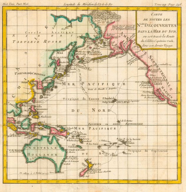
Subject: Pacific Ocean

Period: 1790 (circa)

Publication: Histoire Universelle

Color: Hand Color

Size:
9 x 9 inches
22.9 x 22.9 cm
Download High Resolution Image
(or just click on image to launch the Zoom viewer)

Small copper engraved map that illustrates the voyages of Capt. James Cook through the Pacific. It covers the North American coastline from Mexico through Alaska, and the Asian coastline through Cambodia and the islands of Indonesia. Australia is shown still connected to Terre de Diemen. The route of the Spanish galleons between the Philippines and Acapulco is shown.

References:

Condition: B

Issued folding, now pressed. Some faint foxing.

Estimate: $120 - $160

Sold for: $240

Closed on 9/20/2006

Archived