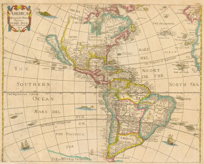
Subject: Western Hemisphere
Period: 1652 (dated)
Publication: Heylin's Cosmographie
Color: Hand Color
Size:
16.6 x 13.3 inches
42.2 x 33.8 cm
This map of the Americas is based on the work of Abraham Goos for John Speed's atlas. It depicts California as an Island, no Great Lakes and a faint allusion to the northwest coast of North America. On the east coast Maryland, No: Belgium, and Long Ile are named. The name Carolina also appears off the coast. According to Burden this may be an accidental misspelling of the 'Carolana' of Sir Robert Heath's grant from 1629, or a possible reference to the French fort in present day Florida. The name Carolina was not used until 1660. The map is decorated with a title cartouche, sea monsters, and sailing ships. This is the first state.
References: Burden #308; McLaughlin #13; Tooley (America) p.115, #11.
Condition: B
Issued folding and now pressed. This example has good margins, except for tiny areas in the bottom margin that have been professionally replaced. This map is usually found with deficient margins. Small stain at bottom center.