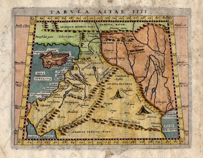
Subject: Near and Middle East
Period: 1608 (published)
Publication: Geographiae Universae Tum Veteris…
Color: Hand Color
Size:
6.7 x 5 inches
17 x 12.7 cm
This is a nice example of Magini's Ptolemaic map of the Near East, with Cyprus and the eastern Mediterranean, north to name Armenia. Includes present day Turkey and Iraq with the Tigris and Euphrates Rivers. Bedouin encampments are shown in the interior of Arabia Deserta. The map covers the entire Holy Land with many ancient coastal place names including Ptoleumais, Sidon, and Tripolis. A handsome chart with fully engraved stipple seas.
References: Mickwitz & Miekkavaara #230-18.
Condition: B
Scattered staining from an unknown sources and some closed breaks in paper. Full, original margins and later coloring.