Subject: Asia
Period: 1720 (circa)
Publication:
Color: Hand Color
Size:
21.3 x 17 inches
54.1 x 43.2 cm
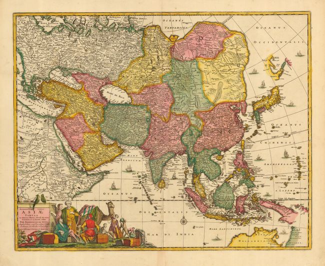
This handsome, large map of the continent and East Indies shows the extent of European knowledge of the region. It is vividly rendered with good detail throughout the south and south east reflecting the surveys of the Dutch East India Company, while northern and central Asia is filled mostly with mountains, deserts and forests. The work of the Jesuit missionaries is reflected in the well-documented region of China. The large title cartouche includes a busy scene including a Jesuit and traders with their exotic cargo. This is the second state, published by Covens and Mortier.
References: Yeo #59.
Condition: A
Fine impression and original color. Old repair on bottom centerfold.