Catalog Archive
Auction 116, Lot 471

"A Mapp of the Kingdome of Dennmarke, with Its Severall Dioceses or Provinces. Designed by Monsieur Sanson, Geo.", Blome, Richard

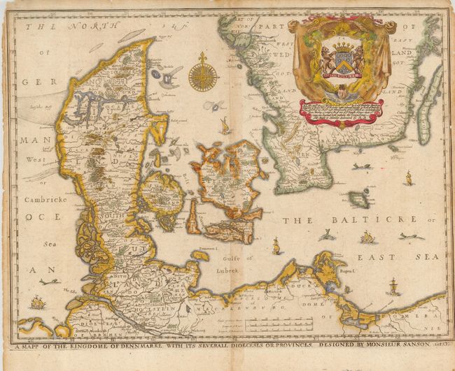
Subject: Denmark and Baltic

Period: 1670 (circa)

Publication: Geographical Description Of The Four Parts Of The World

Color: Hand Color

Size:
15.7 x 11.8 inches
39.9 x 30 cm
Download High Resolution Image
(or just click on image to launch the Zoom viewer)

This scarce map is from the first atlas to be wholly engraved, printed and published in England. This map covers all of Denmark and also parts of northern Poland and Germany to include all of Holstein, the islands of Sjaelland, Fyn and Lolland, and the southern part of Sweden. The map is embellished with an elaborate heraldic cartouche and a dedication to "George, Lord Berkeley...descended from Harding a younger son of one of ye Danish Kings…" Further decorated with one of the finest 32-point compass roses we've seen, plus seas filled ships and sea monsters. The 24 maps in the atlas were engraved by Francis Lamb, Thomas Burnford and Wenceslas Hollar. This map is after Sanson and was engraved by Hollar.

Richard Blome was one of the most interesting, and most active, publishers of illustrated books in post-Restoration London. There is an excellent biography on MapForum.com.

References:

Condition: B

Printed on thin hand laid paper with close margins sides and top. Later full coloring. Rough edges to sides and top, short marginal split along centerfold at top and bottom and some centerfold toning.

Estimate: $200 - $300

Sold for: $120

Closed on 9/20/2006

Archived