Subject: South Pole
Period: 1645 (circa)
Publication:
Color: Hand Color
Size:
19.5 x 17 inches
49.5 x 43.2 cm
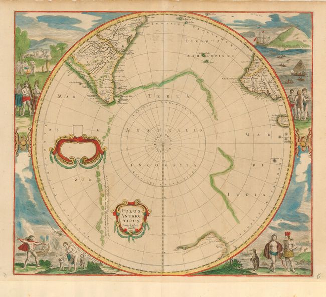
This early map of the south pole was originally drawn by Henricus Hondius in 1641. It is considered one of the earliest realistic maps of the Antarctic continent, which is partially delineated in a combination of coastline and strings of islands noted as first discovered by Magellan. The circular map also shows parts of South America, Africa and Madagascar with the incomplete coastline Australia. Early Dutch explorations in the region are noted. The map is surrounded by fabulous engravings of natives and early explorers. In this second state, the small title cartouche includes Jansson's imprint with the dedication cartouche blank.
References: Tooley MCC -2, #21.
Condition: B
Original color with some minor offsetting. Margins extended at bottom and at right for binding in a composite atlas.