Subject: Northern Europe and Scandinavia
Period: 1561 (published)
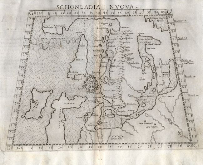
Publication: La Geografia di Claudio Tolomeo
Color: Black & White
Size:
9.8 x 7.1 inches
24.9 x 18 cm
This fine copperplate map is presented on a trapezoidal projection is one of the earliest obtainable maps of Scandinavia. It is Ruscelli's 'modern' map of Greenland, Scandinavia, and northern Europe, although there are still several Ptolemaic features of the map. Norway is separated from Greenland by a narrow strait and Iceland is depicted as a long, thin island called Thyle, which is depicted larger than Ireland. Part of Britain is presented in its unique early form in which Scotland appears to be jutting sharply to the east. The Faroes and Shetlands are one island group. First state with Italian text on verso.
References:
Condition: B
Minor toning along centerfold. Couple of tiny wormholes in blank margin.