Subject: Jamaica
Period: 1775-80 (circa)
Publication:
Color: Hand Color
Size:
22 x 19 inches
55.9 x 48.3 cm
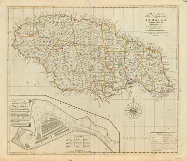
This is an uncommon map of Jamaica divided into eighteen parishes. Trelawny Parish, which was created in 1770, is not shown. The map is filled with detail of the towns and villages, Gentleman's Seats, churches, forts, roads, sugar works, various plantations, rivers, springs and ponds, harbors, anchorages, soundings, and much more. At bottom is a large plan of Port Royal with a key listing the important buildings and showing how the town was affected by the earthquake of 1692 that destroyed much of the city. Not listed in Sellers and Van Ee, although it appears to be based on the Carrington maps listed as #1926 and 1927.
References: Phillips/Le Gear (A) #5988-34.
Condition: B
Backed with linen, apparently as issued. Original outline color. Some scattered foxing. Two stains in upper margin, not affecting map.