Catalog Archive
Auction 116, Lot 364

"The Windward Passage, with the several Passages, from the East End of Cuba, and the North part of St. Domingo", Jefferys, Thomas
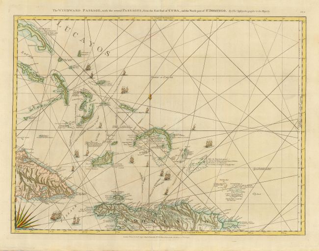
Subject: Caribbean

Period: 1775 (dated)

Publication: The West-India Atlas

Color: Hand Color

Size:
24.8 x 19 inches
63 x 48.3 cm
Download High Resolution Image
(or just click on image to launch the Zoom viewer)

This superb nautical chart covers the shipping channel between Cuba and Hispaniola and the Turks and Caicos Islands north of the passage. Several ships' tracks are shown along with great detail of anchorages, shoals, soundings, etc. Beautifully engraved, the sheet is decorated with rhumb lines, a splendid compass rose and tiny ships. This is the first state with Robert Sayer's imprint at bottom. It is one sheet of the sixteen-sheet map of the West Indies that formed the heart of this important Revolutionary period atlas. Sheet number CH.8 printed at upper right.

References: Phillips (A) #2699; Sellers and Van Ee #1735.

Condition: A

Estimate: $850 - $950

Sold for: $650

Closed on 9/20/2006

Archived