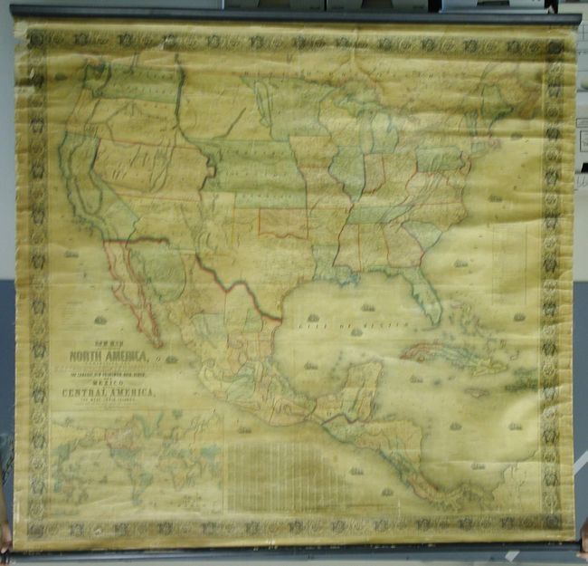
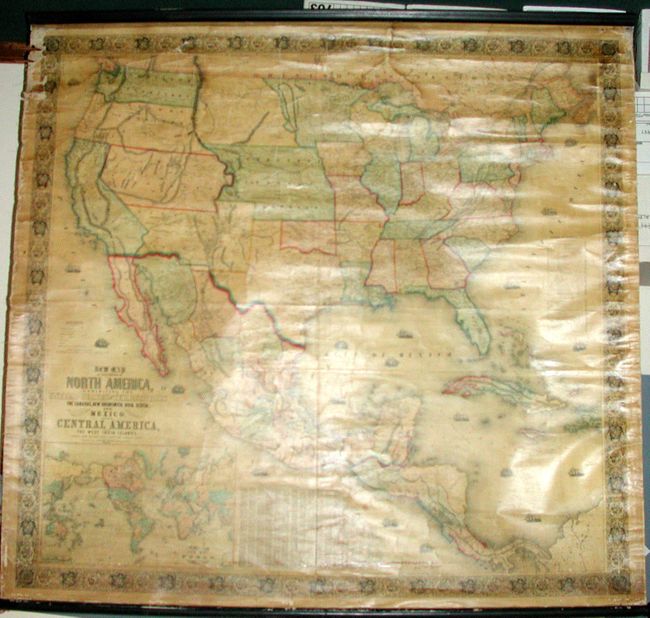
Subject: United States & Mexico
Period: 1854 (dated)
Publication:
Color: Hand Color
Size:
59 x 55.8 inches
149.9 x 141.7 cm
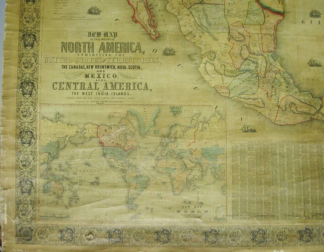
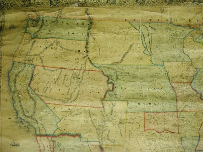
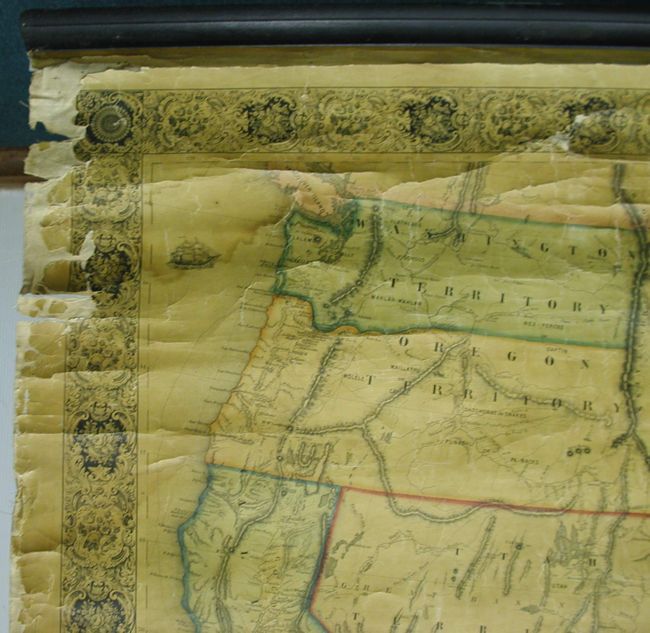
This majestic wall map was published just as the country was beginning to expand fully to the Pacific following the land gains after the Mexican War. The gold region in California is remarkably inaccurate with Auburn shown well north of Sacramento City and lying between it and the Marysville & Yuba City area. The Great Basin area is also inaccurate and roughly follows the Fremont model. Filled with wagon routes, explorer's trails, forts, Indian tribes, and so much more. The middle portion of the U.S. is unorganized with only Indian nations named and colored. Much of this area is organized into the Proposed Territory of Nebraska. Minnesota includes Dakota, which is not named. Out west, only California and the territories of Oregon, New Mexico and Utah exist. Includes a table of distances and a table of counties and towns with more than 1,200 names. Large inset of the World on Mercator's projection. Embellished with decorative borders and numerous engraved sailing and steam/sail ships in the oceans. Complete with both original wooden rollers and original linen backing. Published by Hoen & Company.
References: Wheat (TMW) #794; Wheat (GOLD) 243; Rumsey #602.
Condition: A
Very nice color, clean and bright example. A little light water staining along right edge, and some from top into Wisconsin. Some roughness along upper left edge with very slight loss to border. Hint of old adhesive at bottom just above border.