Subject: Southwestern United States, Mexico and Central America
Period: 1845 (dated)
Publication: Morse's North American Atlas
Color: Printed Color
Size:
15 x 12 inches
38.1 x 30.5 cm
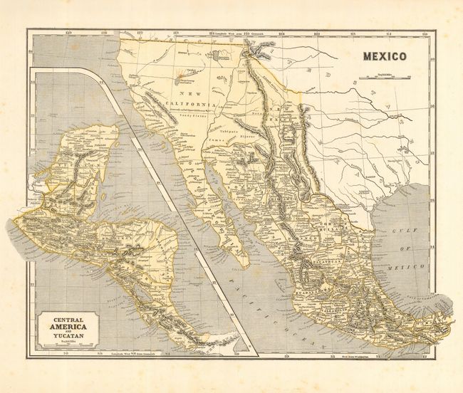
This map was printed using the revolutionary cerographic process, a milestone in cartographic printing techniques. This early printed color technique was an important change in the way maps were produced and the only truly American cartographic publishing innovation.
This is a very nice, unfolded example of this early cerographic map with full printed yellow coloring. Wheat notes that this is the same map as published by the company in 1842. California and the western states are controlled by Mexico and shown as New California. Texas is Independent and the settlements of Austin, Nacogdoches, and S. Antonio de Bexar are located. This pre-Fremont map shows a large swamp in the area of today's Great Basin with rivers flowing across its expanse. The Great Salt Lake is here named L. Youia (salt) with the American Fur Depot on its eastern shore. With a large inset map "Central America and Yucatan."
References: Wheat (TMW) #469.
Condition: B
Nice impression with wide, original margins. A few light foxing spots, else fine.