Subject: United States & Mexico, Texas
Period: 1842 (circa)
Publication:
Color: Hand Color
Size:
15 x 12 inches
38.1 x 30.5 cm
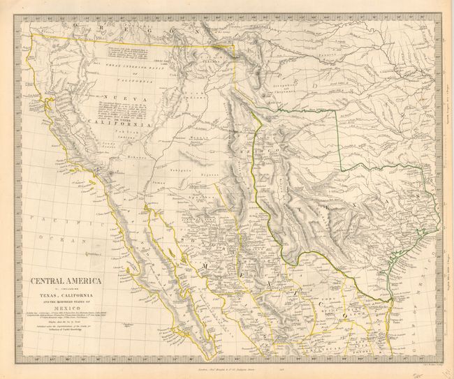
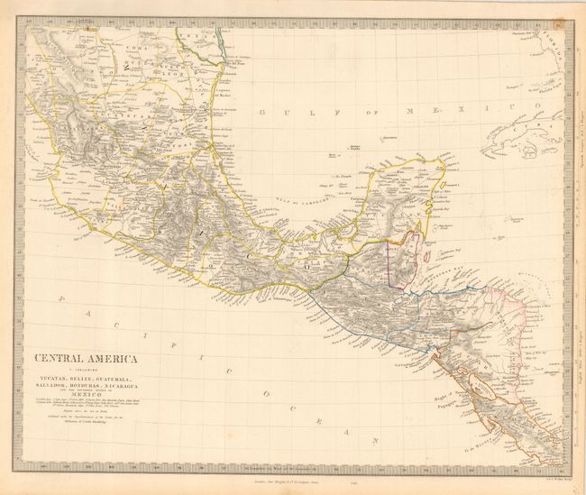
The star here is the first map that, despite the title, covers the Southwestern United States and Texas just a few years before Mexico lost the region to the United States in the Mexican/American War. Texas is shown as Independent with its panhandle extending well north up to Spanish Peaks. All of the Southwest and California are here noted as being "Generally called Upper California." Large swamps and lakes are shown in the Great Basin, draining through a complex R. Buenaventura system. Good detail throughout including forts, Indian tribes, etc. The map is filled with interesting notations including a "Supposed Petrified Forest" in the western part of Texas, and "Supposed residence of the Aztecs in 12th century (Humboldt)" in the Moquis (Hopi) region of present-day Arizona. The second map extends south from above Guadalajara to include part of Costa Rica. Both engraved by J. & C. Walker and published by Charles Knight & Co., 22 Ludgate Street.
References: Day p. 37; Wheat [TMW] #460.
Condition: A
Both with fine original hand coloring in outline. A little marginal toning with one spot in border of sheet I.