Subject: United States & Mexico
Period: 1814 (dated)
Publication: A New General Atlas
Color: Hand Color
Size:
24.5 x 20 inches
62.2 x 50.8 cm
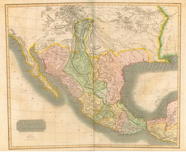
Large, attractive and significant map that depicts the Spanish possessions in North America. Especially noteworthy is the delineation of the great river systems, particularly the Platte flowing east and south of the Rocky Mtns. Spanish control of the Southwest is limited to part of Texas and a strip of Land in present day New Mexico which includes Santa Fe and Albuquerque. In this edition, Pikes Peak is not named but is labeled as the "Highest Peak." According to Wheat, the map originated primarily from the epic Humboldt and Pike maps and to some extent the Pinkerton and Arrowsmith maps published a few years earlier. Texas appears within the province of St. Louis de Potosi, which is also labeled New Santander. The very handsome map names many Indian tribes and villages, with terrific early information on topography and watershed.
References: Wheat (TMW) #320.
Condition: B
Fine impression and coloring with wide margins. A little light foxing or staining in blank areas, else very good.