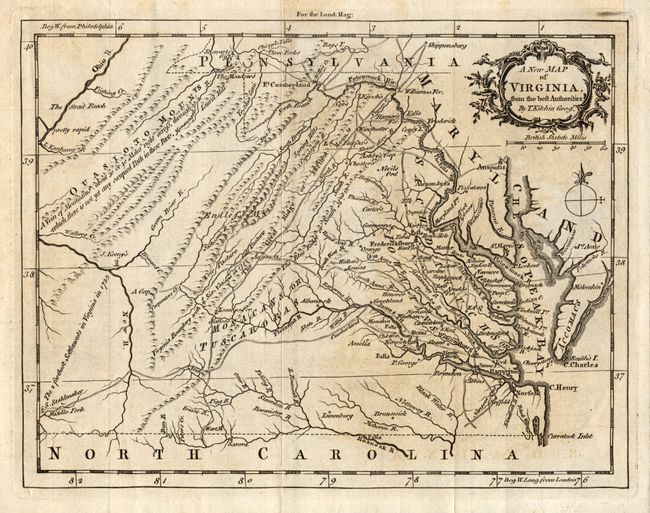
Subject: Colonial Virginia
Period: 1761 (published)
Publication: London Magazine
Color: Black & White
Size:
9 x 7 inches
22.9 x 17.8 cm
This uncommon map of colonial Virginia is filled with detail of early towns, roads, rivers, waterfalls, ferry crossings, Indian boundaries and interesting notations. On the Middle Fork of the Holston River is the farm of S. Stahlmaker and at the junction of the Green Briar and New Rivers is the homestead of J. Keeny's. These are described as the farthest western settlements in Virginia in 1755. The title is contained in a decorative cartouche above the distance scale and compass rose.
References: Jolly LOND-205; Sellers and Van Ee #1436.
Condition: B
Fine impression on hand laid paper with full margins. Light region of toning in right half, else fine.