Subject: Texas
Period: 1842 (published)
Publication: Sen. Ex. Doc. 199, 27th Cong., 2nd Sess.
Color: Black & White
Size:
8.5 x 6.5 inches
21.6 x 16.5 cm
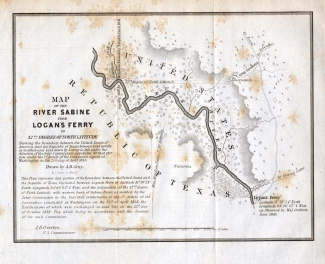
This is one of six maps issued with the report on the boundary survey between the Republic of Texas and the United States. The act admitting Louisiana to statehood in 1812 contained a clause defining its original boundaries. When Texas declared its independence in 1835, these borders came into question. This survey was made shortly thereafter and appears to have been the basis for a more detailed survey in 1840 to determine the eastern boundary of Texas. The map depicts the boundary starting from a point on the river about 1/2 mile above Garrison Creek and down the river to Logan's Ferry (where the boundary ceases to follow the river). The map is minutely detailed and filled with fascinating notations. Drawn by A.B. Gray, engraved by W.J. Stone and signed by J.H. Overton, U.S. Commissioner. A rare, and important part of Texas' cartographic history.
References:
Condition: B
Folding, as issued, with full original margins. Scattered foxing, else fine.