Subject: Oklahoma
Period: 1879 (dated)
Publication: Sen. Ex Doc No. 20 46th Cong., 1st Sess.
Color: Printed Color
Size:
22 x 15 inches
55.9 x 38.1 cm
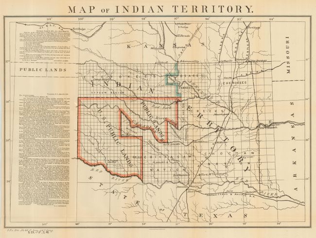
A desirable map that depicts the territory with the first designation of Public Lands. Included in a panel to the side of the map are two fascinating letters concerning the disposition of the Public Lands within the territory. The first, by Congressman Augustus Albert contains a list of questions. The answers, by Col. E.C. Boudinot, attempts to "set the records straight" by detailing how the land was acquired from the Indians, its current status, and directions to "several million acres of the richest land on the continent." A number of army forts are named and located. The original publishing credit of Sen. Ex. Doc. No. 20, 46th Cong., 1st Session is at lower left. A significant and important map for any Oklahoma collection.
References:
Condition: A
Folding, as issued on fine paper with full, original margins. Hint of fold toning, else fine.