Subject: Dakota Territory
Period: 1882 (dated)
Publication: Sen. Doc. #283, 48th Congress 1st Sess.
Color: Printed Color
Size:
24 x 29 inches
61 x 73.7 cm
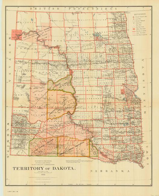
A striking county map of the territory that shows Bismarck as the capitol and the location of military and Indian reservations, railroads, the extent of Northern Pacific Railroad, land grants, cities, towns, county seats, and more. The majority of the western portion of the territory is devoted to Indian Reservations. Economic development is still largely limited to the eastern portion of the territory. By 1880 cattlemen [many from Texas] occupied most of Dakota's range land. Drawn by C. Roeser, Principal Draughtsman. This large, detailed and beautifully lithographed map, was printed by the firm of Julius Bien, N.Y.
References:
Condition: A
Originally issued folding, now pressed. Just a hint of toning on folds, else fine.