Subject: District of Columbia
Period: 1825 (published)
Publication: Atlas Geographique, Statistique, Historique et Chronologique…
Color: Hand Color
Size:
10 x 10.5 inches
25.4 x 26.7 cm
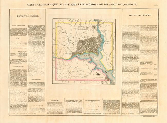
This lovely map is from the French edition of Carey & Lea's atlas. Detail of the District of Columbia and George Town includes unnamed individual streets and parks. The Navy Yard, Marine Hospital, White House (Maison du President), and the Capitol are identified. Within the map is the title "District de Columbie." The map measures as given above and is on a full sheet measuring 27.3 x 21.3" with panels of French text, including population figures, the at sides and bottom. At the time, Washington, D.C. had a total population of only 33,000.
References:
Condition: A
On a large sheet of thick paper with full, original margins. Lovely original hand coloring in pastel tones. A little light toning or foxing in areas outside of map and two tiny spots within map, else fine.