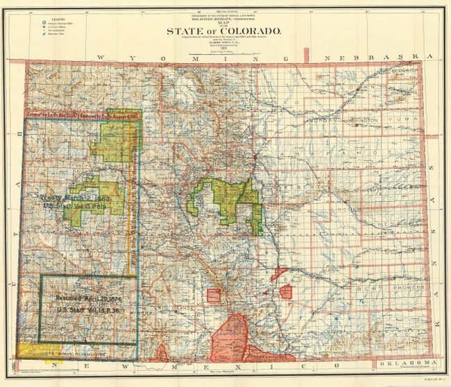
Subject: Colorado
Period: 1902 (dated)
Publication: Sen Doc 34, 57th Cong., 1st Sess.
Color: Printed Color
Size:
34 x 28.5 inches
86.4 x 72.4 cm
This is the large edition (scale of 12 miles per inch) of this map published while Harry King was the Chief of Drafting. It is filled with a huge amount of detail including railroads, land grants, forts, military reservations, Indian reservations, forest reserves, non-subdivided land sections, and treaty lands with notations on date and document number. Adams County is not shown indicating county development is current through 1901. This large and beautifully colored map in extraordinary condition provides a detailed look at the state just after the turn of the century.
References:
Condition: A+
Folding, as issued with full original margins and bright, strong color and impression.