Subject: California, San Francisco
Period: 1859 (dated)
Publication:
Color: Hand Color
Size:
34.5 x 23.8 inches
87.6 x 60.5 cm
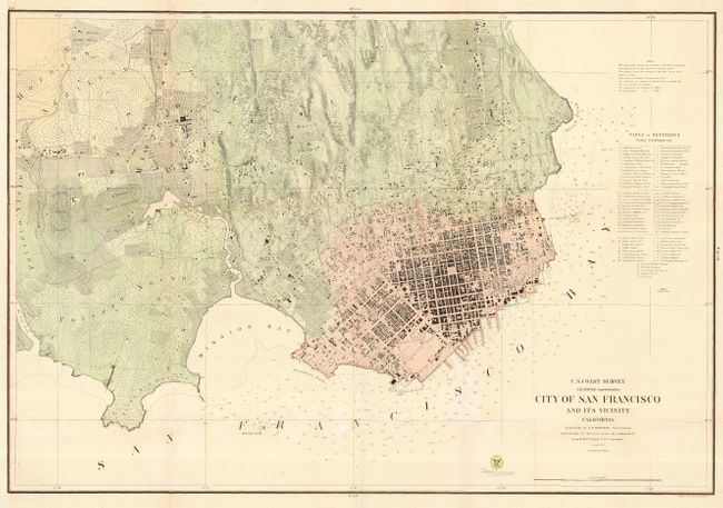
This large and terrific plan illustrates early San Francisco. This very detailed map is similar in title to the 1853 edition, but is a completely different map. On a scale of 6" per mile, the street and building detail is amazing with hundreds of individual houses and buildings located. Topographical detail is shown with 20-ft. contour lines throughout the map. A Table of Reference locates over 70 public buildings and at least seventeen wharves and piers are named. Map extends west to show the Union and Pioneers Race Courses, the Mission de Dolores and Rancho de San Miguel. A large and early plan of San Francisco drawn by A. F. Rodgers with the hydrography by Lieut. R. M. Cuyler.
References:
Condition: B
Backed with Japanese tissue to support folds.