Catalog Archive
Auction 116, Lot 238

"Plan du Port de St. Francois Situe sur la cote de la Californie Septentrionale…", La Perouse, Comte Jean F. Galoup, de

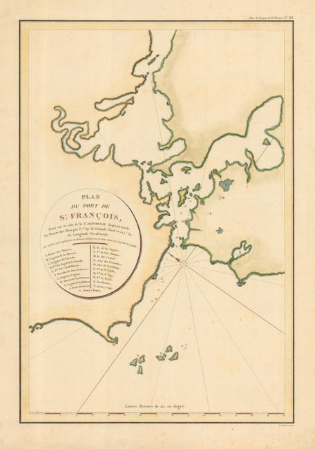
Subject: California, San Francisco

Period: 1797 (published)

Publication: Atlas du Voyage de La Perouse

Color: Hand Color

Size:
13 x 19.3 inches
33 x 49 cm
Download High Resolution Image
(or just click on image to launch the Zoom viewer)

This chart is one of the earliest obtainable maps of San Francisco Bay. La Perouse sailed the California coast in 1786 before setting out for the Philippines on his fateful expedition. His map was based on Dalrymple's map of 1789 with information derived from Spanish sources including Josef Camacho and Jose de Canizares. The map includes 21 place names, including Alcatraz and the Presidio.

References: Harlow #15; Wagner (NW) #846.

Condition: A

Bit of light foxing in margins.

Estimate: $750 - $850

Sold for: $750

Closed on 9/20/2006

Archived