Subject: Southwestern United States
Period: 1856 (dated)
Publication: Atlas of the World
Color: Hand Color
Size:
15.8 x 12.8 inches
40.1 x 32.5 cm
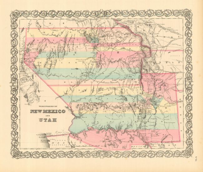
This is the first edition of the most interesting map that details Utah and New Mexico Territories when they were in their largest configuration. Utah encompasses all of today's Nevada and extends west to the Continental Divide in present-day Colorado. Fillmore City in central Utah is the capital. New Mexico Territory includes part of southern Colorado and stretches west to include Arizona and the southern tip of present-day Nevada. The map locates Fremont's routes, the proposed routes for the Pacific Railroad, the Spanish Trail, and much more. This lot includes the original atlas text page that describes the region. A fine example of a very desirable map that Wheat found important enough to use as the frontispiece to Volume 4 of his Mapping the Trans-Mississippi West. With Colton's decorative scroll-style border.
References: Wheat (TMW) #832 (frontispiece); Phillips & LeGear #816, 6116, 6125.
Condition: A+
Very nice example with fine coloring and crisp impression on a full sheet with wide margins. With a spot or two in margin and edge toning, still fine.