Subject: Northwestern United States
Period: 1862 (circa)
Publication: Mitchell's General Atlas
Color: Hand Color
Size:
13.3 x 10.6 inches
33.8 x 26.9 cm
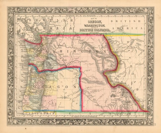
In 1859, Oregon became a state and in the process, Washington gained land from the eastern part of Oregon Territory; the region that would eventually become Idaho Territory in 1863. This map shows this unusual territorial configuration and clearly shows the Oregon Trail, here called the Emigrant Route from the States. It also shows the California route, here called the Emigrant Waggon Road, which separates from the Oregon trail at South Pass. The entire eastern half of Oregon is labeled 'unexplored' and only three large regions are shown west of the Cascades - Klamath, Curry and Wasgoren (likely an editing error for Wasco).
References:
Condition: A
Strong impression and original color. A couple of minor flaws in margin, else fine.