Subject: Western United States
Period: 1866 (circa)
Publication: General Atlas
Color: Hand Color
Size:
22.5 x 17.3 inches
57.2 x 43.9 cm
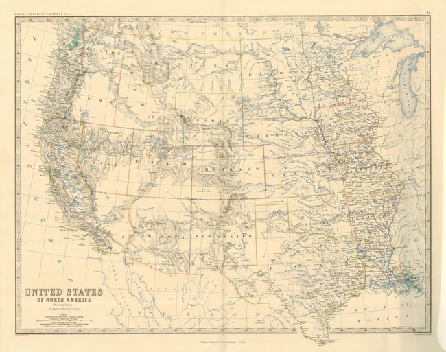
This terrific map of the states and territories west of the Mississippi River shows an interesting period in America's westward expansion and state development. Washington and Oregon have their correct state boundaries, but Idaho and Wyoming are a little confused. In its northern portion, Utah extends too far eastward also taking from Wyoming. Nevada has a flat southern border with today's southern tip still part of Arizona Territory. Tucson appears to be Arizona's capital city. Dakota Territory is still one large territory and Okalahoma is Indian Territory.
References:
Condition: A+
Beautiful example that has been carefully encapsulated in archival Mylar.