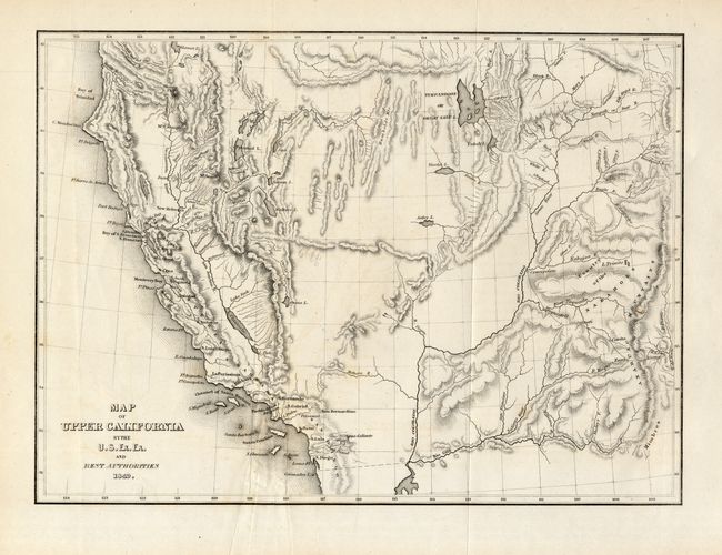
Subject: Western United States
Period: 1849 (dated)
Publication:
Color: Black & White
Size:
11.5 x 8.4 inches
29.2 x 21.3 cm
This map covers all the American West south of 42° N. and west of the Anahuac Mountains (the Rockies) with by far the greatest detail in California, particularly in the Gold Region. In this later edition, the Colorado River has a more accurate course through today's northern Arizona. The map was drawn almost entirely from Fremont's maps of 1845 and 1848, replicating Fremont's famous topographical error, showing an east-west mountain range across the unexplored area of the Great Basin. The course of Mary's River (Humboldt River) is depicted with relative accuracy. Los Angeles is a tiny Pueblo de los Angelos.
References: cf. Wheat (TMW) #654; cf. Wheat (Gold) #135.
Condition: A
Nice example with full margins. Hint of offsetting at lower left and some soft creases from mis-folding. Issued folding, now pressed and professionally encapsulated in archival Mylar.