Subject: Midwestern United States, Wisconsin, Minnesota
Period: 1827 (published)
Publication: Atlas Universel
Color: Hand Color
Size:
20.5 x 18.5 inches
52.1 x 47 cm
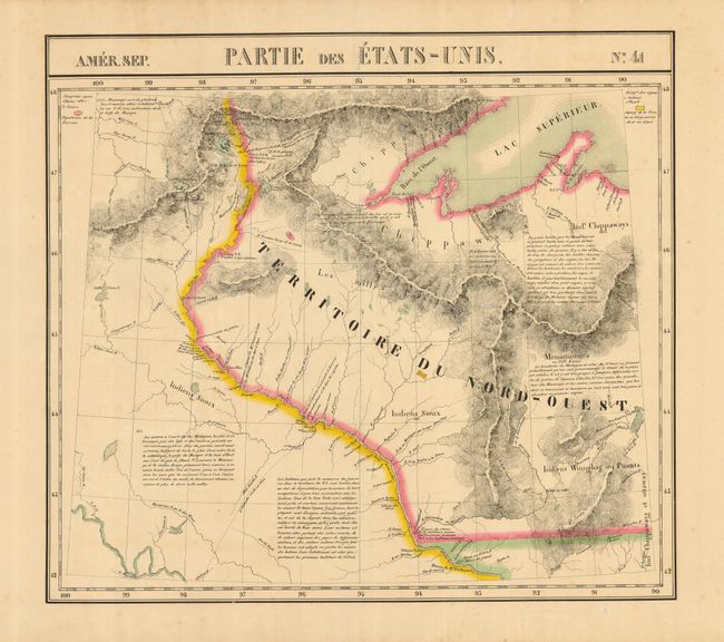
This graphic, large-scale map features the area of Wisconsin and Minnesota, noted here as the huge Territoire du Nord-Ouest, part of Lake Superior and the source of the Mississippi River. The map is filled with topographical information, forts, Indian villages, mines and notations.
The Atlas Universel was the first atlas to present all the maps on the same scale (1: 1,641,836), with each map covering an area of approximately 20 degrees longitude (from Paris) and 6 degrees of latitude. Also considered to be the first lithographic atlas ever published. There was only one edition, published in 1825-27, and the subscription list shows that 810 copies were sold.
References: Phillips (A) #749.
Condition: A
Lovely original color with a hint of light foxing, still overall very good.