Subject: Colonial Midwestern United States
Period: 1733 (circa)
Publication:
Color: Hand Color
Size:
26 x 19.2 inches
66 x 48.8 cm
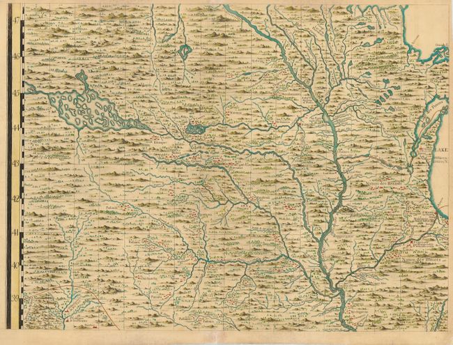
Henry Popple's 1733 map is one of the most important large-scale colonial maps of North America. It consisted of 20 folio sheets, each containing an amazing amount of information. This sheet covers the region of present-day southern Minnesota, Iowa, northern Illinois and Wisconsin. Popple used primarily French sources for the delineation of the rivers and mountains. Most of the names are French transliterations of the Indian place names, e.g., Ouisconsing for the Wisconsin River and Quicapous for Kickapoos. A portage is marked at the future site of Chicago and the Mission of Saint Francois Xavier is locate at what will become Green Bay. Lead mines are located near what would become a major lead-mining district at Galena and a copper mine is located near Peoria. Numerous French forts are located, as are hundreds of Indian villages. Though much of the topography is entirely imaginary, it fills the map in a unique manner and makes for a very interesting composition.
References: Schwartz & Ehrenberg #151; Buisseret "From Sea Charts to Satellite Images" p. 73.
Condition: A
Minor repairs of marginal fold separations.