Subject: United States - Southeast
Period: 1794 (dated)
Publication:
Color: Hand Color
Size:
24.8 x 19.5 inches
63 x 49.5 cm
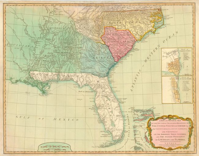
This is the second edition of this important map that was first published in 1776 in a British military atlas. In this edition the title has been revised to acknowledge the United States. The map is based on the work of De Brahm, Collet, Mouzon and the important hydrographical surveys of the coast of Florida and the Bahamas by Bernard Romans. It includes inset plans of St. Augustine and Charleston above the decorative title cartouche. The map is most noteworthy for its depiction of East and West Florida. The coastline of the Florida peninsula is accurately depicted but the interior remains virtually unknown with a spine of mountains, labeled the Great Sandy Ridge, extending down the center of the peninsula. The map is filled with information concerning the Indian Nations, with numerous trails, roads and villages located.
References: Tooley (Amer) pp. 98-9, #78.
Condition: B
Full original color. Some damp stain entering map at top and repairs along centerfold.