Subject: United States - Southern
Period: 1865 (dated)
Publication:
Color: Black & White
Size:
45 x 27 inches
114.3 x 68.6 cm
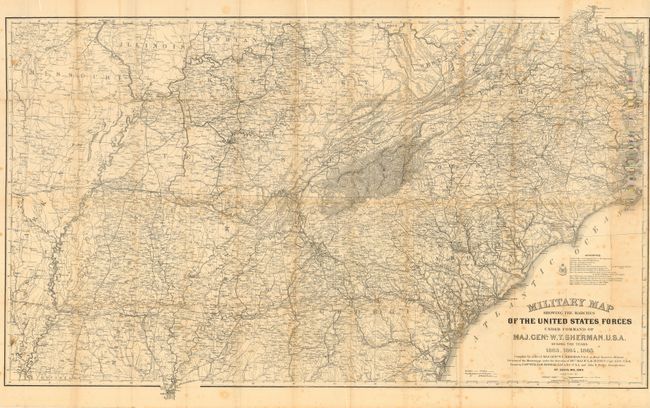
This is the original and full sized version drawn by Captain William Kossak in St. Louis MO and printed by the Ferd. Mayer company of New York during the Civil War. The map was compiled under the direction of Bvt. Maj. W.L.B. Jenney by order of General Sherman. It covers the region bounded by Mobile in the south, Washington and St. Louis in the north, east to Chesapeake Bay and as far west as Little Rock. Absolutely filled with remarkable details including all roads and trails, towns and villages, rivers, creeks, and railroads. Legend locates Infantry, Cavalry, U.S. fortifications and Rebel fortifications. A long list of source maps names 13 authorities. Folding as issued to about 3.5" x 7.5".
References:
Condition: B
Great impression on sound paper with full, original margins. A little scattered foxing, more at lower right, a little fold toning, else a near fine example with no tears or splits.