Subject: Colonial South
Period: 1778 (published)
Publication: Atlante Novissimo
Color: Hand Color
Size:
16.6 x 12.4 inches
42.2 x 31.5 cm
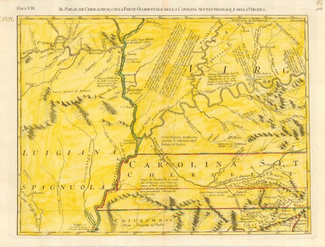
This great regional map provides a detailed view of the Missouri and Ohio Rivers along the Mississippi and adjacent areas. While the map is filled with Indian villages, it shows very little European settlement other than a couple of French forts. It also notes Dr. Thomas Walker's settlement. Walker, a surveyor for the Ohio and Loyal Land Companies, led a small group into the area in 1750 and established a supply post in the area of present-day Barbourville, Kentucky. Drawn from the earliest available English and indigenous surveys, this is the Italian edition of Mitchell's seminal map of the British Dominions in North America that Zatta issued in 12 sections with the whole titled "Le Colonie Unite dell' America Settentrle." Zatta's maps retain Mitchell's scale, but being smaller are more legible. Block titling above neatline.
References: Portinaro & Knirsch #150; Sellers and Van Ee #163.
Condition: A
Printed on thick hand laid paper with adequate margins that appear to be original. Two watermarks. Later full wash coloring in yellow added to original outline color.