Subject: Indonesia & Australia
Period: 1724-26 (circa)
Publication: Oud en Nieuw Oost-Indien
Color: Hand Color
Size:
21.5 x 17.5 inches
54.6 x 44.5 cm
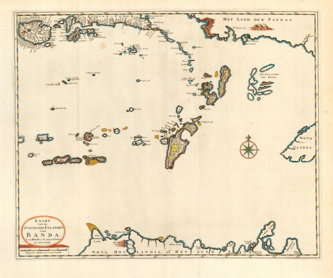
A fascinating map of the East Indies, centered on Timor, from this important history of the Dutch East India Company (VOC). The map shows numerous islands of the Indonesia archipelago as well as part of Nova Guinea and Het Land der Papoas (Papua New Guinea) and the northern coast of Australia, here named Nova Hollandia, or Het Zuyd Land (the "South Land"). Valentyn’s account, published by Joannes van Braam and Gerard onder de Linden, detailed the discoveries of Abel Tasman in Australasia during the course of his two voyages of 1642 and 1644. This chart is from the description of Tasman’s first voyage, which was the first to circumnavigate the Australasia region and to give it recognizable geographical limits, proving that it was not part of the great southern continent.
References:
Condition: B
Crisp, early impression with some layout lines still evident. Thick, hand laid paper with wide margins. Recent hand coloring in outline.