Subject: Northern Asia
Period: 1676 (circa)
Publication: A Prospect of the Most Famous Parts of the World
Color: Black & White
Size:
20 x 15.4 inches
50.8 x 39.1 cm
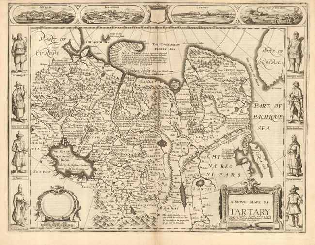
Carte-de-figures map covering the region from Lake Baikal through the regions of present-day Manchuria and Siberia to the north of the Great Wall of China. Korea is shown as an island on the extreme right with parts of North America across the fabled Strait of Anian. The map is fully engraved with mountains and forests, numerous towns and fascinating notations. Included in the four views at top is a view of Novaya Zemlya, the winter quarters of Barents who searched for a northern passage between Russia and America. The other views depict important cities of the Silk Route - Astrakan, Samarkand and Cambalu. In the side panels are figures of the people of Tartary in their native costume. The English text on verso provides a fascinating contemporary description of the region. Imprint of Bassett and Chiswell. English text on verso.
References:
Condition: B
Dark impression with light toning along centerfold, else very good to fine. Close top margin, as issued, and two small hinge tape remnants at top corners of margin.