Subject: Europe - Western
Period: 1561-74 (circa)
Publication: La Geografia di Claudio Tolomeo
Color: Black & White
Size:
9.8 x 7 inches
24.9 x 17.8 cm
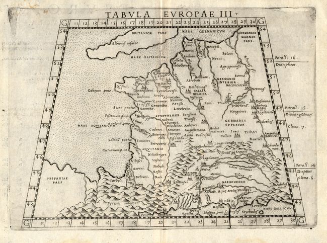
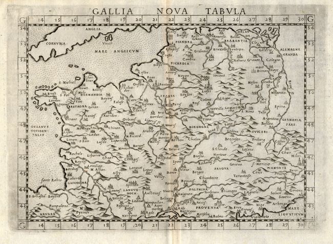
Pair of copper engraved maps depicting the western regions of Europe in Ptolemaic and modern form. The Ptolemaic map is presented in a trapezoidal border. It shows an extensive band of mountains in the north of Spain labeled the Pyrenei montes. Locates the regions of Lugdunensis, Aquitania, Narbonensis, Germania Superior, Germania Inferior, Gallica Belgica and Britanicae Pars. An apparent crack in the plate is visible at the lower border along the 25° mark. The modern map shows completely different topography and makes a great comparison.
References:
Condition: A
Dark, early impression with some layout lines still evident. On fine hand laid paper with full margins. A little light marginal foxing.