Subject: Italy
Period: 1798 (dated)
Publication:
Color: Hand Color
Size:
27 x 23.5 inches
68.6 x 59.7 cm
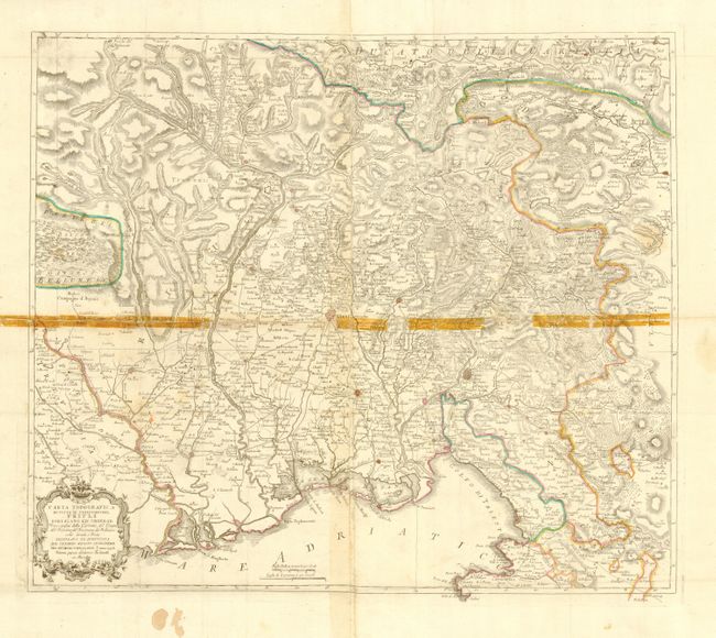
Scarce Italian produced map showing the state of Friuli-Venezia Giulia and centered on Unine. The map is filled with remarkable detail of the region between Trieste and Carole along the Adriatic coast and north to the Carnic Alps. Sheet locates roads, villages and towns, rivers, mountains, and fortified cities. Decorative rococo-style title cartouche and two distance scales. Two sheets, joined as issued.
References:
Condition: C
Delicate impression, original coloring and very wide margins. Lightly toned along centerfold, strongly toned along one horizontal fold line from previously applied tape, thankfully now removed and replaced with archival tape. Small hole in lower border.