Catalog Archive
Auction 115, Lot 578

"Carte de la Grece", Ottens, Reiner and Joshua

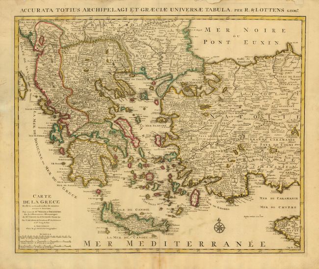
Subject: Greece & Turkey

Period: 1730 (circa)

Publication:

Color: Hand Color

Size:
22.8 x 18.6 inches
57.9 x 47.2 cm
Download High Resolution Image
(or just click on image to launch the Zoom viewer)

A striking, large map detailing Greece, the western part of Turkey and extending to show Albania, Macedonia and part of Cyprus. Latin title at top "Accurata Totius Archipelagi et Graeciae Universae Tabula."

References:

Condition: B

Original outline color with some faint spotting. Minor defects in the blank margins.

Estimate: $350 - $400

Unsold

Closed on 6/21/2006

Archived