Catalog Archive
Auction 115, Lot 567

"Kamieniec Podolski Ville Forte des Estats de Pologne", Fer, Nicolas de
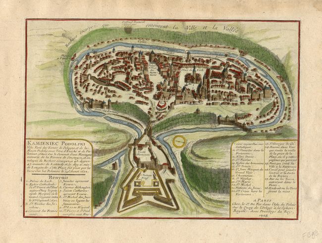
Subject: Ukraine

Period: 1705 (dated)

Publication: Les Forces de l' Europe…

Color: Hand Color

Size:
11.4 x 8.3 inches
29 x 21.1 cm
Download High Resolution Image
(or just click on image to launch the Zoom viewer)

This bird's-eye view of the fortified a Polish fortress in Podolia, is now the Ukrainian town of Kamianets-Podilskyi. The city is situated in a naturally protected site encircled by the Smotrich River and enveloped by a rocky escarpment. Two large forts guard the entrance to the city. The map key lists 28 locations. Nicolas de Fer held the title of Geographer at Louis XIV's court. He was one of the most prolific publishers of plans of European cities in the late seventeenth century.

References: Pollak #21, p. 40.

Condition: A

Minor marginal defects, none affecting map.

Estimate: $140 - $180

Sold for: $140

Closed on 6/21/2006

Archived